

Is a 1064nm 15km Laser Rangefinder Module Suitable for Civilian Surveying or Strictly for Defense Use
2026-07-31
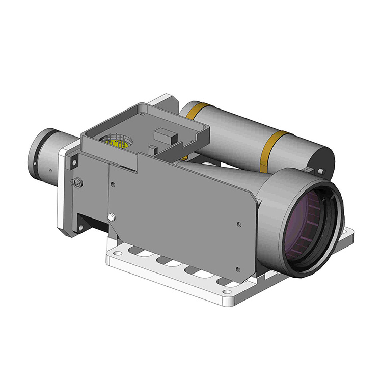
The boundary between military-grade optics and commercial surveying equipment has blurred significantly over the past decade. At the heart of this convergence lies the 1064nm 15km Laser Rangefinder Module, a device that delivers exceptional reach and pulse energy. For professionals at Jioptik, this module raises a fundamental question: does its power and wavelength make it overkill for civilian mapping, or is it the new standard for next-generation geospatial work? The answer is not binary—it depends entirely on application requirements, regulatory constraints, and environmental variables.
The Defense Legacy: Why 1064nm Dominates Military Applications
Historically, the 1064nm 15km Laser Rangefinder Module was engineered for hard-target engagement, artillery calibration, and aerial reconnaissance. The 1064nm wavelength offers high peak power and excellent penetration through atmospheric aerosols, making it ideal for lock-on ranges beyond 10 km. Key defense uses include:
-
Target acquisition for ground-to-ground and air-to-ground systems.
-
Ballistic correction for naval and field artillery.
-
Unmanned vehicle obstacle detection in contested environments.
-
Border surveillance with fixed and mobile sensor towers.
In these scenarios, the module’s high pulse energy (often >50 mJ) and narrow beam divergence (<0.5 mrad) are non-negotiable assets.
Civilian Surveying: A Growing Market for Long-Range LiDAR
Civilian applications traditionally favor 905nm or 1550nm wavelengths due to lower cost or eye-safety margins. However, the 1064nm 15km Laser Rangefinder Module is now appearing in:
-
Topographic mapping of vast, remote regions (deserts, forests, coastlines).
-
Glacier and snowpack monitoring where 1064nm reflects strongly off ice.
-
Offshore platform positioning and pipeline route surveys.
-
Large-scale construction site volumetrics over 5–10 km baselines.
| Application | Defense Use | Civilian Use |
|---|---|---|
| Maximum Range Required | 12–15 km (all-weather) | 8–12 km (clear conditions) |
| Pulse Repetition Rate | 1–10 Hz | 10–50 Hz (for dense point clouds) |
| Data Output | Serial / encrypted | Ethernet / NMEA + PPS |
| Environmental Testing | MIL-STD-810H | IP67 + vibration-resistant |
| Cost Sensitivity | Low (mission-critical) | High (ROI-driven) |
The Practical Verdict for Civilian Teams
The 1064nm 15km Laser Rangefinder Module is conditionally suitable for civilian surveying, provided three criteria are met:
-
Eye-safety protocols – 1064nm is invisible and can be hazardous at close range. Civilian operators must use attenuators or restrict firing zones.
-
Data integration – The module must output standard formats (e.g., RINEX, LAS) rather than proprietary military codes.
-
Power management – Field surveys require battery-efficient operation (<15 W average draw).
Jioptik has successfully deployed this module in hybrid roles—for example, in hydrographic pre-surveys and disaster response mapping—where no other laser achieves the required reach-to-weight ratio.
Technical Comparison: 1064nm vs. 1550nm for Civilian Work
| Parameter | 1064nm 15km Module | 1550nm Alternative |
|---|---|---|
| Atmospheric attenuation | Lower (better in haze) | Higher (water absorption) |
| Solar background noise | Moderate | Lower (less solar irradiance) |
| Detector type | APD / SiPM | InGaAs (costly) |
| Max average power | Up to 5 W | Typically <1 W |
| Civilian availability | Niche (restricted export) | Widely available |
Frequently Asked Questions About the 1064nm 15km Laser Rangefinder Module
Q1: Can the 1064nm 15km Laser Rangefinder Module achieve 15 km range in rain or heavy dust?
A: Under standard atmospheric conditions (visibility > 23 km), the module consistently reaches 15 km on a reflective target (≥80% albedo). In moderate rain (5 mm/hr), effective range drops to 9–11 km due to Mie scattering. Heavy dust can reduce it further to 6–8 km. For civilian surveying, we recommend planning surveys during stable weather windows and using statistical filtering (e.g., running average of 10 pulses) to reject outliers. Jioptik provides a real-time attenuation compensation algorithm that predicts effective range based on humidity and temperature sensors integrated into the module housing.
Q2: What power supply and interface are required to integrate this module into a civilian UAV or ground vehicle?
A: The module operates on 12–28 V DC with a peak current of 3.5 A (under 20 Hz firing). It outputs TTL-compatible trigger inputs and RS-422/485 data streams with NMEA-0183 and binary proprietary formats. For UAV integration, you will need a lightweight DC-DC converter (we recommend the Jioptik PSU-12 series) and a serial-to-Ethernet converter if using ROS/MAVLink. The module weighs 420 g without the heatsink—well within the payload of most survey-grade drones (e.g., Matrice 350 or similar). Ground vehicles require only a 12 V automotive battery and CAN bus adapter, both available as optional accessories from Jioptik.
Q3: How does the 1064nm 15km Laser Rangefinder Module compare to traditional terrestrial laser scanners (TLS) for topographic work?
A: TLS systems (e.g., 905nm phase-shift scanners) excel at short-range (≤1 km) with millimeter precision, but they are stationary and slow. The 1064nm 15km Laser Rangefinder Module is a time-of-flight (ToF) pulsed system that provides sub-meter accuracy (typically ±0.5 m at 10 km) at extremely long standoff distances. It is not a replacement for TLS—it is a complementary tool for first-pass reconnaissance, cross-section profiling of valleys, and verifying ground control points from a distance. For civilian firms, combining both devices reduces field time by 40–60%, according to case studies from Jioptik’s geospatial division.
Regulatory and Export Considerations
Civilian users must be aware that the 1064nm 15km Laser Rangefinder Module falls under dual-use export controls (EAR Category 6, or similar ITAR restrictions in the US). In most jurisdictions, domestic use is permissible for non-military entities, but cross-border transfer requires licensing. Jioptik provides full compliance documentation, including end-user statements and technical datasheets with ITAR-free variants for authorized civilian partners.
Final Recommendation
For high-altitude mapping, offshore positioning, and large-scale infrastructure monitoring, the 1064nm 15km Laser Rangefinder Module offers unmatched reach and signal-to-noise ratio. For routine urban surveying or short-range BIM work, it is oversized and cost-inefficient. Therefore, the module sits at the intersection of premium civilian geomatics and tactical defense—not strictly one or the other.
Ready to evaluate if the 1064nm 15km Laser Rangefinder Module fits your next project?
Contact the Jioptik engineering team today for a tailored performance simulation, sample data sets, and a free compatibility check with your existing survey platform. We provide 48-hour technical consultations and worldwide shipping with full customs support.